Beach trip report
| General Location | South of Wollongong, Shoalhaven Head |
|---|---|
| Aboriginal Tribe/Language Group | Wodi Wodi Aboriginal group |
| Access to beach | Road access within walking distance |
| Beach Classification | Wave Dominated – Intermediate – Traverse Bar & Rip |
| Start Date/Time | 28 March 2017 – 15:21 |
| Start Location (inc Lat/Log) | Nth end at Gerroa S34° 46.381’ E150° 48.918’ |
| End Date/Time | 28 March 2017 – 16:52 |
| End Location (inc Lat/Log) | Sth end at Shoalhaven Head S34°51.685’ E150° 44.960’ |
| Mode of Travel | Bike |
| Distance Travelled | 12.75km / 7.92mls |
| Location of Sand Sample (lat/Long) | S34° 48.333’ E150° 46.169’ |
This beach was selected as the first because it is; suitably located, anticipated as an easy ride and it just happens to be the same name as the place I grew up in Tasmania. All very good reasons to cut my teeth on the start of the Mile Beach Club adventure.
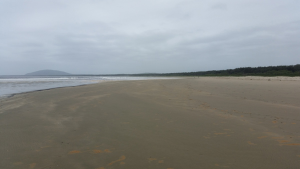
Seven Mile Beach (NSW52383) is one of the longer beaches on the NSW south coast, at 12.75 km (7.9 mile), and is part of the Shoalhaven River delta. The northern headland is occupied by the settlement of Gerroa, which was established in the 1920s. At the base of the headland Crooked Creek flows out over the beach, with a long footbridge providing access from a car park to the northern end of the beach. Seven Mile Beach National Park occupies the central 6 km of the beach and backing barrier, a littoral eucalyptus forest with a ground cover of bracken and Burrawang palms. At the southern end is the settlement of Shoalhaven Heads. Adjacent to Shoalhaven Heads Surf Life Saving Club (S.L.S.C.). is track access onto the southern end of Seven Mile Beach. The southern end is the northern opening for the Shoalhaven River, which periodically closes over.
A short history of the beach
- Prior to the arrival of Europeans, the Wodi Wodi Aborigines who spoke the Tharawal language had lived in the area for tens of thousands of years.
- The first Europeans to traverse the area were the survivors of the wreck of the Sydney Cove who, in 1797, made their way up the coast to Sydney. Only three of an initial seventeen survived the walk.
- In December 1797, the explorer George Bass, during his journey down the South Coast in Governor Hunter’s whaleboat, became the first European to sail along Seven Mile Beach and cross the shoals at the river entrance which he named the Shoalhaven.
- In 1929 Seven Mile Beach became the setting for the first car in Australia to travel over 100 m.p.h. It was raced by Norman Smith, nicknamed “Wizard Smith”.
- In 1933 the first commercial flight from Australia to New Zealand took off from Seven Mile Beach. The flight took 14 hours and 10 minutes. It left Seven Mile Beach at 2.50 am after flying from Sydney in the afternoon. The local paper, the Kiama Independent, recorded the event in its edition of 14 January, 1933: “The largest number of people ever seen on Seven Mile Beach, Gerringong, estimated at well over a thousand, were there on Tuesday, to see the world-famous Southern Cross land in the afternoon and then make her departure in the early hours of Wednesday morning with Air Commodore Sir Charles Kingsford Smith at the controls. A perfect take-off was made shortly before 3.00 am, and amid cheers and good wishes, the flight to New Zealand was commenced. “Those who made the trip to the beach on Tuesday gained some insight into the vast amount of work entailed in preparations for one of these big flights. Weeks of organization culminate in scenes of concentrated activity at the end.”
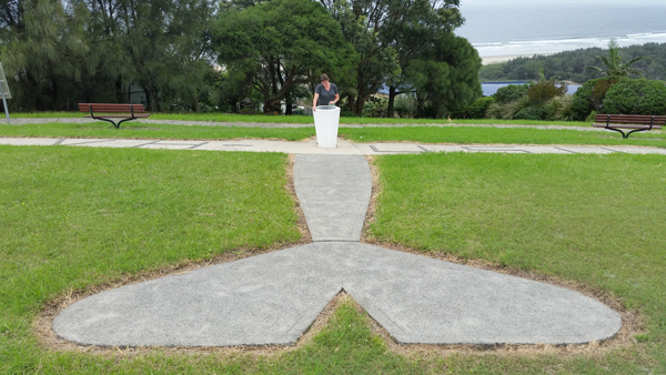
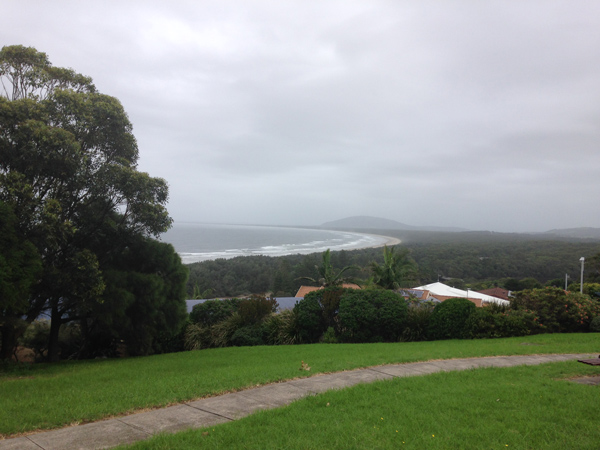
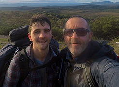
On the first official morning of our around Australia trip we travelled north from Cave Beach Campground, Jervis Bay to Gerroa. Our first stop was at the memorial on Gerroa Headland in recognition of Sir Charles Kingsford Smith inaugural commercial flight to New Zealand. From here it provided us with impressive views of the beach below.
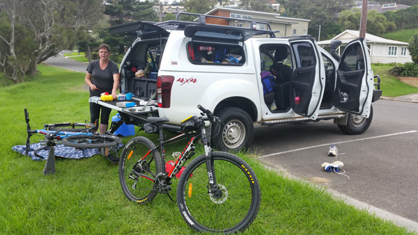
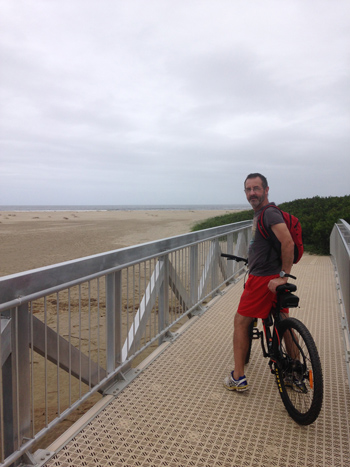
Our next stop and tailgate lunch was at the car park adjacent to the Crooked Creek footbridge. After lunch, I packed provisions into my tiny backpack, did a final inspection of the bike, with Joanne alongside, crossed over the footbridge to the beach.
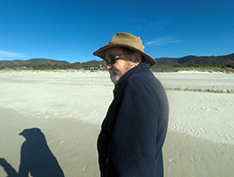
I took some pictures, so did Joanne, then my trusty handheld Garmin eTrex Touch 25 GPS was turned on. After some further celebratory activities, I set off at break neck speed into a slight headwind. After about half a mile even though the sand conditions were ideal for riding I realised I needed to pace myself better, so my gear selection and pace dropped a bit. This also gave me a chance to enjoy the environment and soak up the pleasure of being on a beach again. With the riding, not being very demanding I started remembering many childhood experiences back in Tasmania. Overcast, cool afternoon I could easily, believing I was once again riding down my hometown beach in Tassie.
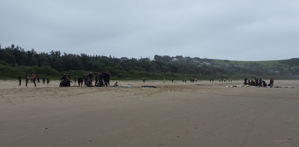
About one mile along the beach I came across a large group of neoprene clothed individual. Flag markers similar to the ones used by S.L.S.C. indicated this was a surf school in progress. I estimate between 30-40 participants. The neoprene people were broken into small groups of about 10 individuals. There was an incredible amount of hooting, high fives and other enthusiastic activity going on. Funny though I couldn’t see anyone in the water actually surfing.
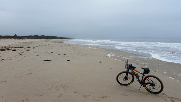
Further on, I met a gentleman riding a mountain bike similar to my own, travelling in the opposite direction. He stopped for a chat, explained he had already been north to south along the beach and was on his return journey back to the footbridge. We spoke for a good while, he had managed to ride all the way to the southern opening of the Shoalhaven River, as the northern river opening was currently closed over.
Further on I met up with Joanne at our first designated way-point. She had road access to the beach through the National Park about 4 km from the start. Joanne provided me with some light refreshments and soon I was back to peddling.
About half way along the beach I stopped for the first of my sand sample collections. This was taken just one metre below what appeared to be the previous high tide mark. I also took this opportunity for a quick swim. The surf was not very big about half a metre, however there was a strong northerly flowing under-toe as I swam out about 20-30 metres from shore. There was a rip about 50 metres just north of where I was swimming which I was careful not to get caught up in.
After drying off I jumped back on the bike delighted and refreshed from the quick dip in the ocean. Further along a group of horse riders travelling north past by and we exchanged greeting. The rest of the ride was slightly harder as the incoming tide forced me higher up the profile of the beach into slightly softer sand.
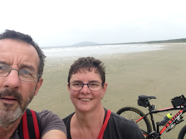
I arrived at the designated southern end of Seven Mile Beach (Northern opening of Shoalhaven River). I was greeted by an enthusiastic and smiling Joanne, who had her own special beach encounter while waiting for me, you can read about that in the Seagull Report. I wish to also note that while this is our shakedown trip and Joanne is acting as my road support for this and the next few beaches, it is not my intention for this to always be the case. On future beach expeditions, I hope and will expect Joanne to loin me.
As the northern opening of Shoalhaven River was closed, and with Joanne’s permission, I continued down the beach along what is commonly called Comerong Island Beach to the southern opening of the Shoalhaven River. I then turned around and cycled back in failing light and a higher incoming tide. I have to say this was a extremely pleasant first ride, bike and rider made it safe and sound. One beach down 46 to go.