Beach trip report
| General Location | Hopetoun |
|---|---|
| Aboriginal Tribe/Language Group | Wudjari Language |
| Access to beach | road to beach car park |
| Beach Classification | Wave Dominated – Intermediate – Low tide terrace |
| Start Date/Time | 8 Feb 2018 10:34 |
| Start Location (inc Lat/Log) | S33° 55.623’ E120° 02.065’ |
| End Date/Time | 8 Feb 2018 12.11 |
| End Location (inc Lat/Log) | S33° 55.613’ E120° 03.647’ |
| Mode of Travel | Bike/walk |
| Distance Travelled | 2.43km |
| Location of Sand Sample (lat/Long) | S33° 55.387’ E120° 02.631’ |
Still excited by my achievements completing Two Mile Beach earlier in the morning, I ignored the growing pain emanating from my right Achilles, the left leg wasn’t too bad so what the heck move on and do Four Mile Beach!
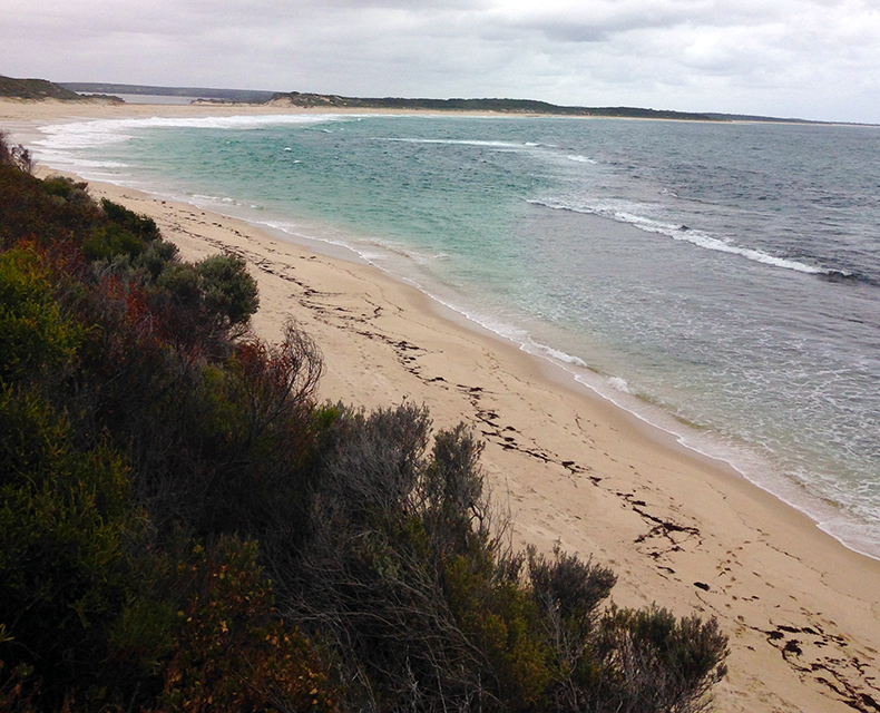
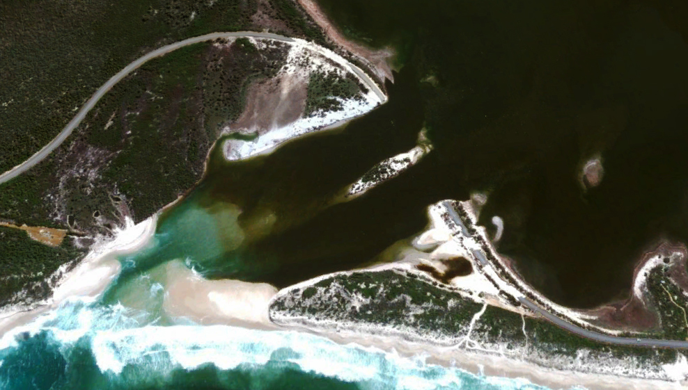
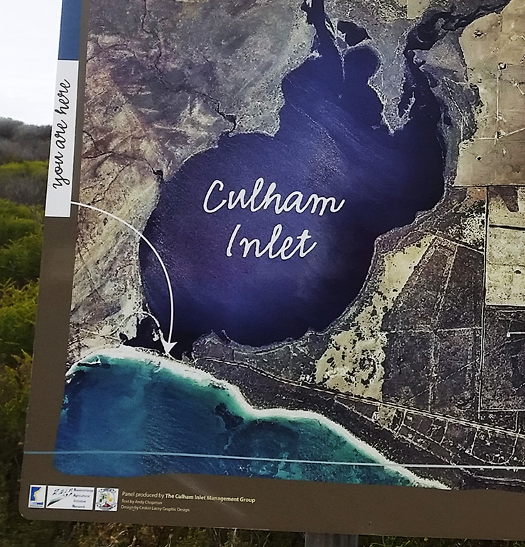
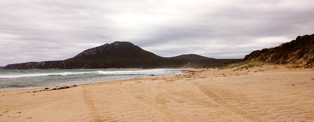
Four Mile Beach extends west from the foreland past a section of intertidal rocks to the usually blocked mouth of Culham Inlet. The inlet marks the eastern boundary of the Fitzgerald River National Park. The beach continues west on the other side of the inlet for another 1.5 km to a 400-metre-long strip of southeast-facing sand that is bordered in the west by a linear reef, and also fronted by a 200 m long section of small rock reef. There is a car park behind the reef section of the beach with the national park ranger station and Four Mile Beach campsite also nearby.
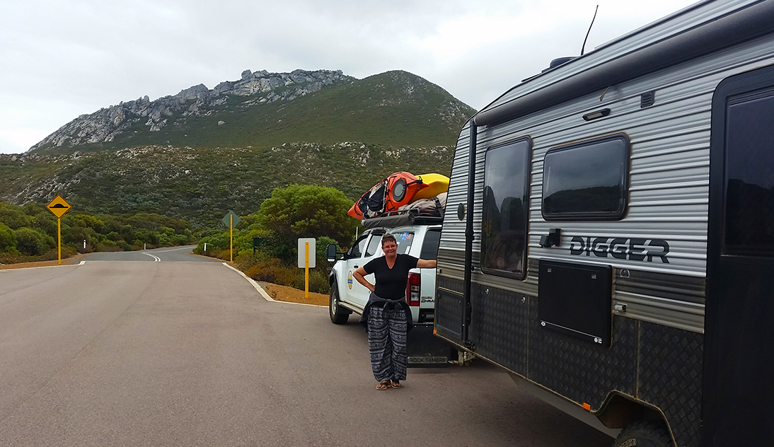
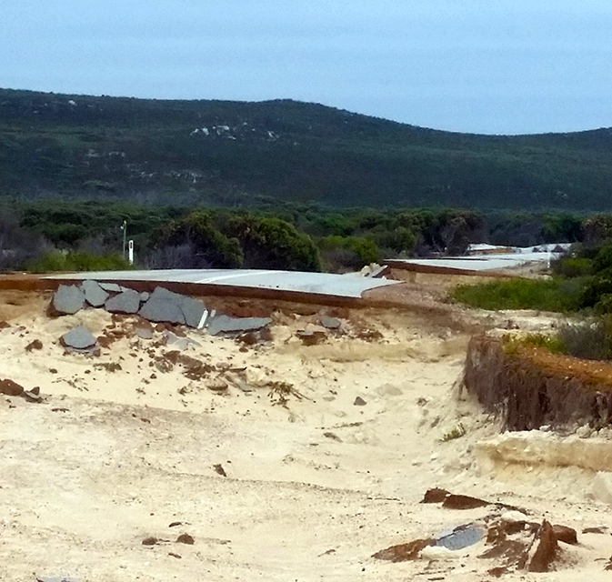
With caravan in tow we headed for the Four Mile Beach car-park western end of the beach. Strange things started happening to the GPS navigator as we crossed Culham Inlet on Hamersley Drive. A massive section of the Hamersley Drive had been washed away during the Feb 2017 floods and a new road which has constructed taking a completely different route across the now dry Inlet.
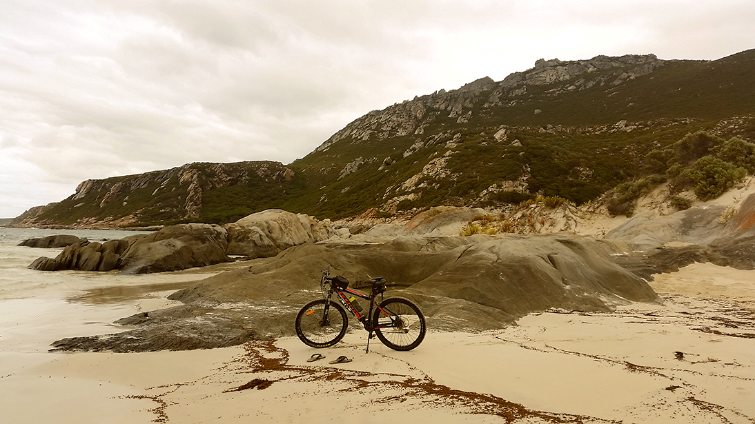
As it was we drove to the carpark, unloaded my bike and proceeded to locate a path or track onto the beach. After a lengthy search we couldn’t locate any defined pathway to the beach. The only man-made feature we could find was a lookout landing at the top of a 10-15 metre steep embankment. It appeared that the floods of February 2017 had also claimed the staircase down to the beach, unfortunately this was not on the list of reconstruction projects.
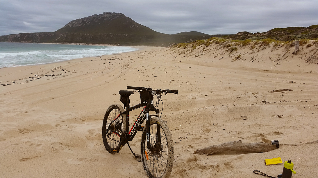
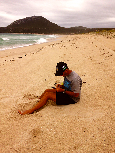
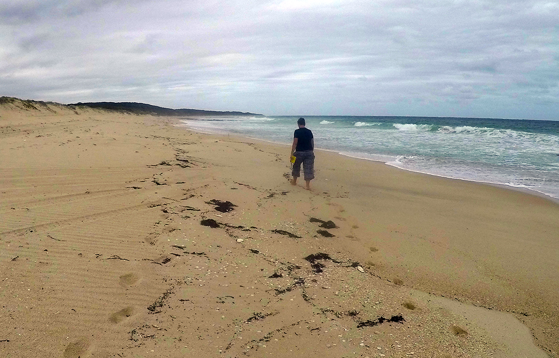
I had no choice but to carry the bike down a makeshift route through thick scrub down the embankment to the beach, in doing so I managed to further strain my already injured right Achilles. Soldiering on, I started the trek from the west end of the beach. I could ride short bursts for the first 1.5km just past Culham Inlet. It was then that conditions started becoming impossible to ride. At one point a huge wave came crashing onto the beach, in attempting to avoid the onslaught of water, I again twisted the right Achilles the wrong way. Fearing I was about to do some severe damage to this part of my body, I phone for an interchange Mile Beach Club member. Lucky Joanne was up at the Four Mile Beach Car park, she drove down Hamersley Drive past Culham Inlet, parked the D-Max and Digger off the side of the road, walked across the dunes, located me sitting crippled on the beach. She took the handheld Garmin GPS, the official waterproof Mile Beach Club notebook and immediately headed off along the beach to complete Four Mile Beach on foot.
Now some might say what a heartless thing to do; leaving an injured companion on the beach alone. However, our agreement was the mission came first; the Mile Beach Club project. Joanne successfully managed to reach the eastern end of the beach then turned around walked back to where I was still sitting on the sand. I managed to limp back with her, through the dunes, to where the D-Max was parked satisfied the job was done.