Many, many years ago as part of an Australian Army qualification course for my ECN 263-2 (Army types will know what that means) I had to produce a terrain analysis report on a specified area, using just topographic maps and some aerial photographs. The area I was given for this project was Cape Bedford. Since that time, I have always had a fascination and desire to visit this interesting geographic feature. Well I finally managed to tick off this personal bucket list item.
About Cape Bedford
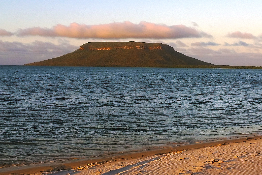
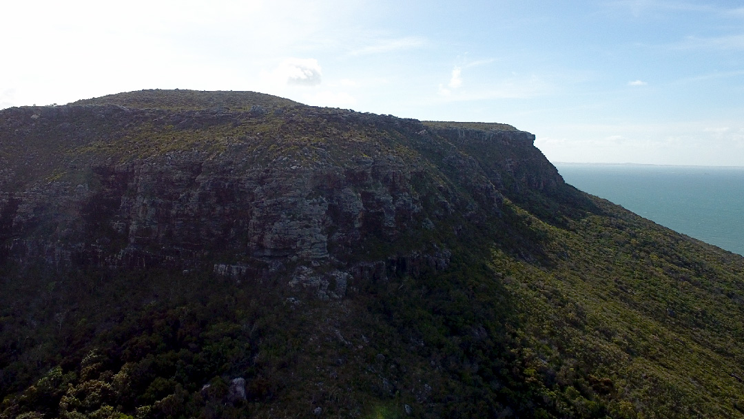
Cape Bedford is composed of resilient horizontal bedded sandstone which forms the 246-metre-high table top cape. The underlying structures surrounding the cape are formed from softer sandstone which over time has eroded to form the gentler surrounding slopes.
Cape Bedford was named on the 4 August 1770 by Lt James Cook, probably after John Russell, 4th Duke of Bedford, First Lord of the Admiralty, 1744-47.
Cape Bedford is unfortunately also the location for a dreadful massacre on 20 February 1879. Native Police Sub-inspector Stanhope O’Connor and his troops, hunted down and hemmed in a group of Guuyu-Yimidhirr Aborigines in a gorge at Cape Bedford. There were 28 men and 13 women. Twenty four men were killed, shot on the nearby beach the remaining four swam out into the sea never seen again. Just two weeks later O’Connor and his six Aboriginal troopers, arrived in northern Victoria to led the hunt for Ned Kelly. Later, they were also involved in the capture of Kelly at Glenrowan.
The Trek
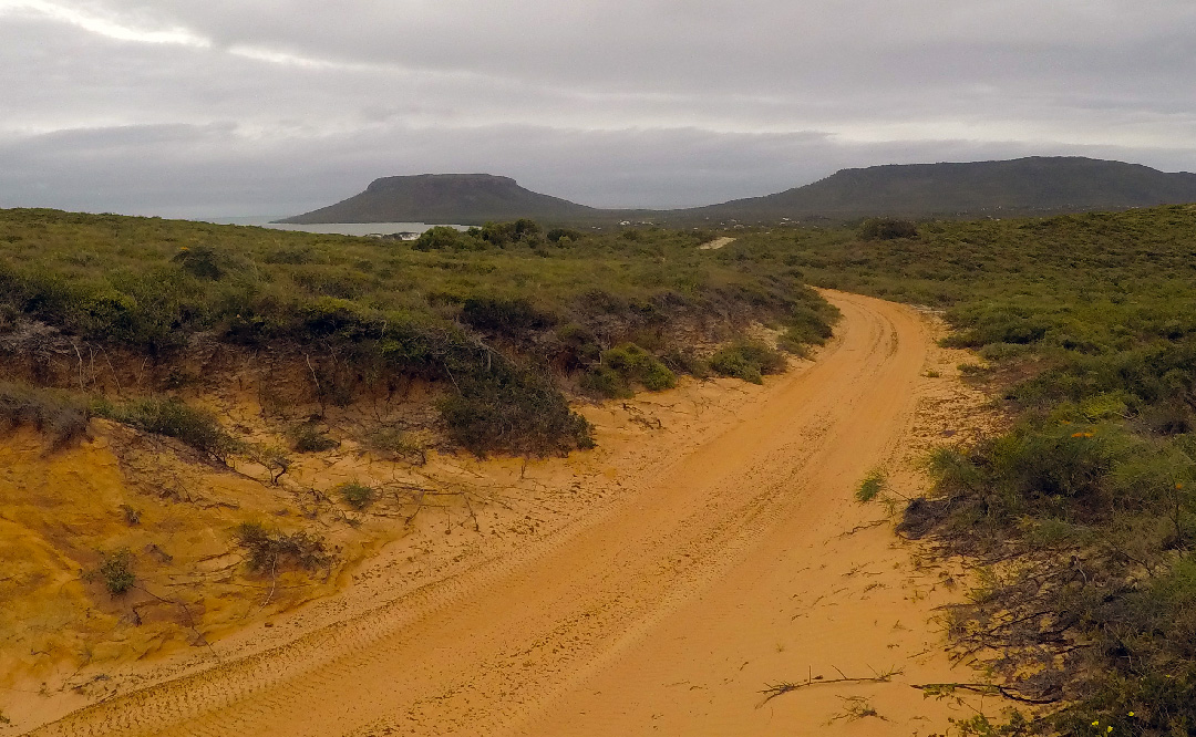
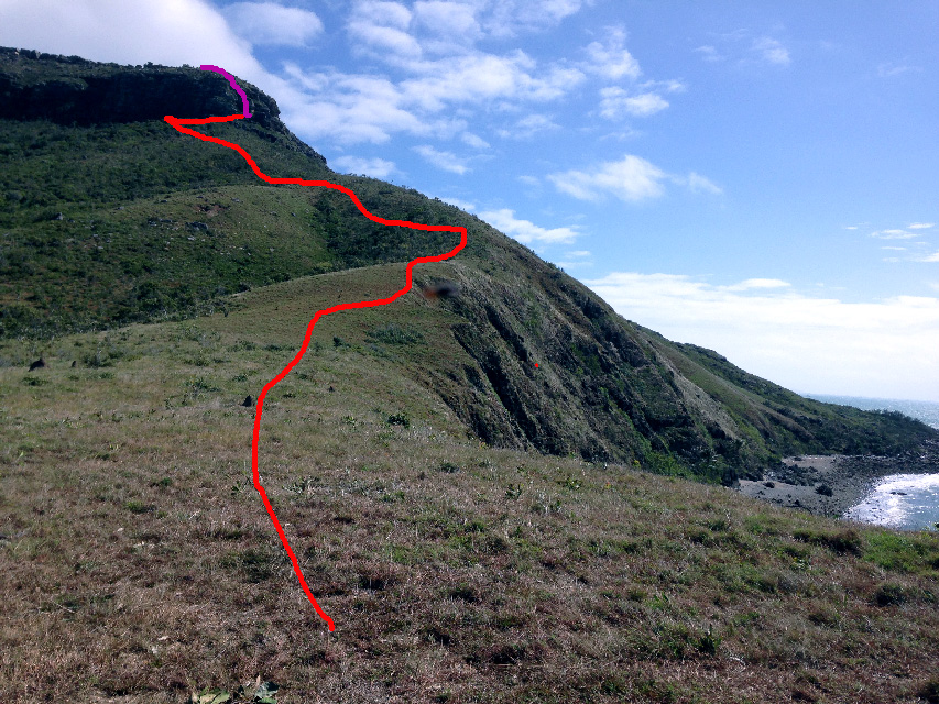
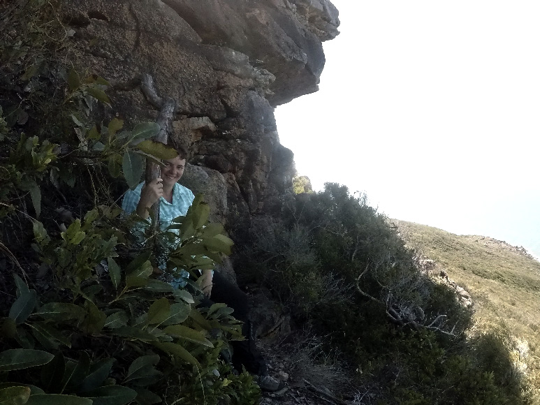
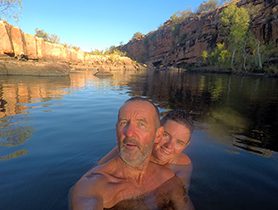
Joanne and I drove the 7km along the challenging 4WD track from Elim Beach Campground. Local advise was there was a walking track leading to the top from the south-east, we arrived at the base on the south-eastern side of Cape Bedford at 11:16. We could not locate any hiking track so with packs and provisions, decided to create our own way up the slope. It took the two of us just over 90 minutes to reach the base of the sandstone cliff face which surround the cape. We had a light lunch and some water then leaving our packs under an overhang section of the cliff we explored the region for some possible route to the summit. Unfortunately, after significant searching we could not find a path suitable for both of us.
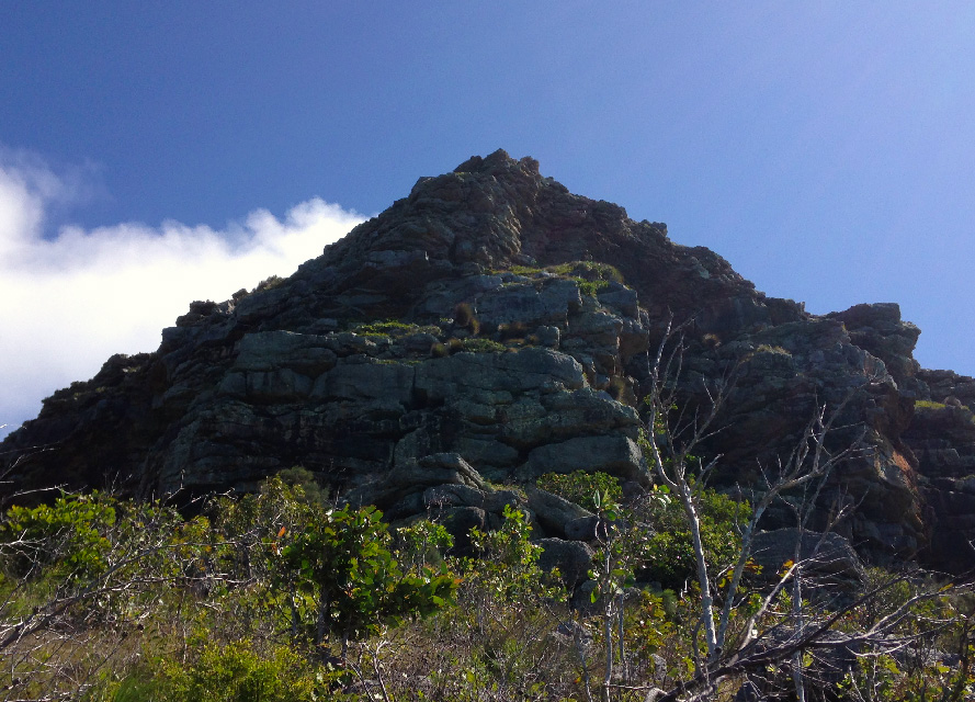
On the GPS I had the altitude at 186-metres. Based on my best assumptions the cliff face above us was between 30-40 metres in height. I eventually found what looked like the most likely section of cliff to climb. With a nylon rope, GPS, Go-Pro and reluctantly Joanne’s permission; I commenced climbing the cliff face on my own at 14:04. Initially I found the assent quite good however about half way up things started to change. There were very few safe reliable hand holds and the face was vertical with a lot of overhanging outcrops. The sandstone surface was loosening and crumbling in places. The most troubling thing was the route I had taken there was no way of backtracking given the nature and condition of the cliff face —- I was forced to climb to the top like it or not.
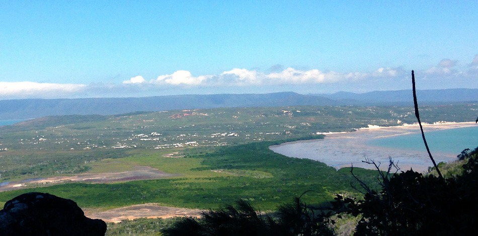
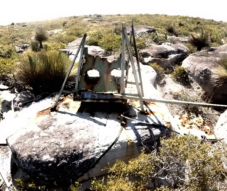
The last 10 -metres was probably some of the most harrowing and heart pounding moments of my life. The rope I was carrying was slung over my shoulder and even if I had been able to unravel it, there was really no way it could have assisted me in that situation. I just knew I had to make slow and careful choices on hand and foot placement, and inch my way up. It took 32 minutes to reach the top of the cliff face at 223-metres. You can only imagine my delight and relief when I could finally stand on level ground again. Using my GPS I quickly skipped across the top of the cape and located the exact highest point of this feature which is 246 metres. I had reached the top of Cape Bedford a feat I had only dreamt about for years. I also located the rusty remains of the old trig point marker. Trig markers were important survey and navigational markers that pre-date GPS assisted navigation.
I had promised Joanne I would return before 3pm so after looking at my GPS and seeing it was already 2:40pm I had little time to ponder the view or my recent achievement. In some ways, I was more concerned about missing my 3pm deadline with Joanne than how I was going to scale back down the cliff. I had left Joanne on a narrow rock ledge alone. I knew there was no way I could descend the same way I had come up so the search began for a new route down.
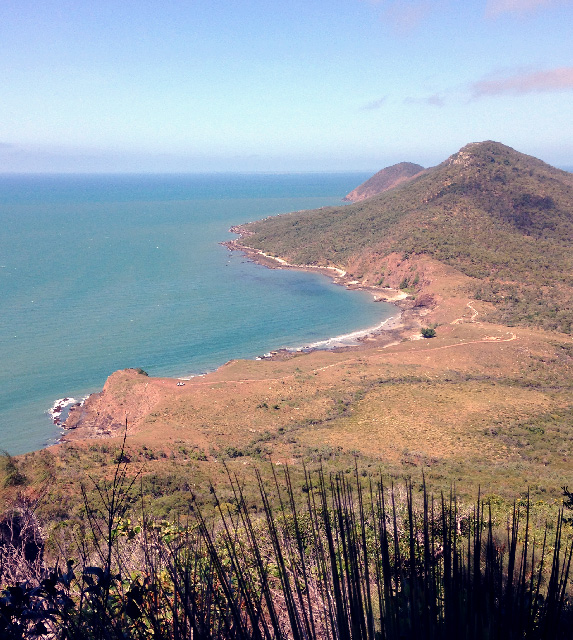
I searched carefully along the top of the eastern cliff face to locate a suitable place to descend. It was about 300 metres along from where I had come up, I found a small gully that appeared to have a suitable course down. I made it down about half way to a small ledge at one end the rock was moist and even though it appeared the easier route down I was not going to descend over wet rock. I selected the other end of the ledge, secured my rope and abseiled down to the base of the cliff. After recovering and recoiling the rope, I checked my GPS position, I was 285 metre east but at the same altitude from where Joanne was sitting it was 14:48 so I had some quick bush bashing through thick scrub to get back to her location.
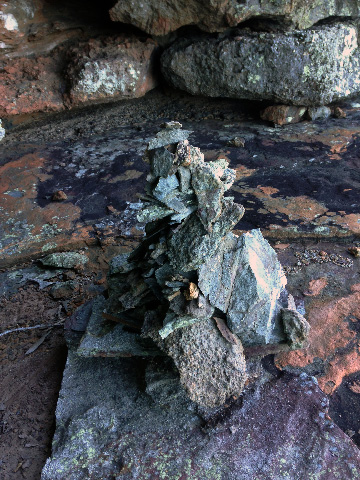
Jo said she would give me till 3pm and then she was going to take off to amble her way down the mountain without me. She had spent her time sitting on this ledge building a rock pillar trying take her mind off the perils I had put myself into!. I made it back to Joanne with 3 minutes to spare.
The walk back to the car was hard going on ankles. We later learnt from the local advisers they had never walked to the top, but were only going on what a few other travellers told them – thanks guys. I will admit I had some trouble getting to sleep that night; kept awake recalling my ascent up the cliff face – something I finally admitted to Jo the following day.
hi guys
john and jean pay we met at the big 4 in Townsville if you can remember
great to read your adventures as we came back to cold Melbourne last Friday
and back to work. keep having fun and enjoy the freedom .
regards john
Hi Jean and John was lovely meeting you in Townsville hope all is well with both of you and we look forward to catching up again sometime. We are currently in Bamaga After a exciting, eventful trek on the Freshman and Old Telegraph Track.
Hi you two, looks like life is treating you like Kings and Queens. I am fully Jealous and we are definitely going to visit one of your camp sites on the way somewhere sometime. Especially now that David has seen the website, photos and itinerary. Great Photos and Great to see Chris is now smiling in the photos!!!!!!!!!!!!!!!!!!!, so this life obviously suits you. How’s the muscle development going Jo. You both must be at the peak of your fitness by now!!!!!!!!!!!!!!!!!!
Cheers Felicity
May the road rise to meet you,
May the wind be always at your back.
May the sun shine warm upon your face,
The rains fall soft upon your fields.
And until we meet again,
May God hold you in the palm of his hand.
May God be with you and bless you:
May you see your children’s children.
May you be poor in misfortune,
Rich in blessings.
May you know nothing but happiness
From this day forward.
May the road rise up to meet you
May the wind be always at your back
May the warm rays of sun fall upon your home
And may the hand of a friend always be near.
May green be the grass you walk on,
May blue be the skies above you,
May pure be the joys that surround you,
May true be the hearts that love you.
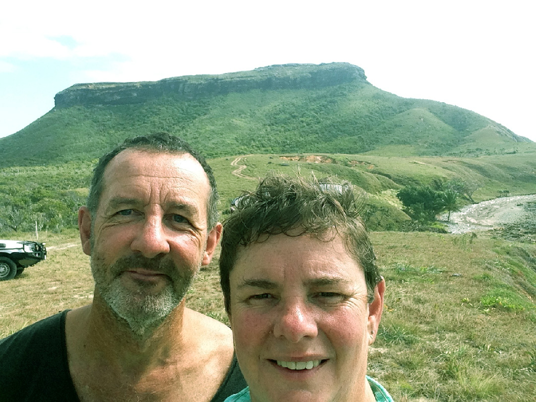
Hi Felicity thanks for all the kind words and verse. We are having a fantastic time, it’s a great adventure. Yesterday we did the last section of the Old Telegraph Track and had some issues getting through the last water crossing. We however have woken again today in Sunny Bamaga with smiles on our faces while we attempt to dry all our gear out.
Love Joanne and Chris
Hey mate, thanks for writing this piece. You helped give me confidence with my adventure when I was at Elim beach camp site and managed to find some internet signal.
Extremely Sorry for the late reply (years) I just have not been working on the website for a long time. I’m happy your experience at Elim beach was enhanced by my report. I love that place been back a few times